I received an interesting email from a geologist, also a close family friend. While researching for a road project at the Kazakhstan-China border, he became curious about the peculiar landscape patterns he came across on Google Earth. These are a battery of colluvial spots, each about 30m wide, distributed homogeneously across a gently sloping ground of loose material. He, an excellent field geologist, couldn’t ascribe these to any geomorphological origin, and became genuinely curious if this could be the habitat use pattern of a “groundhog-like” burrow dwelling creature.
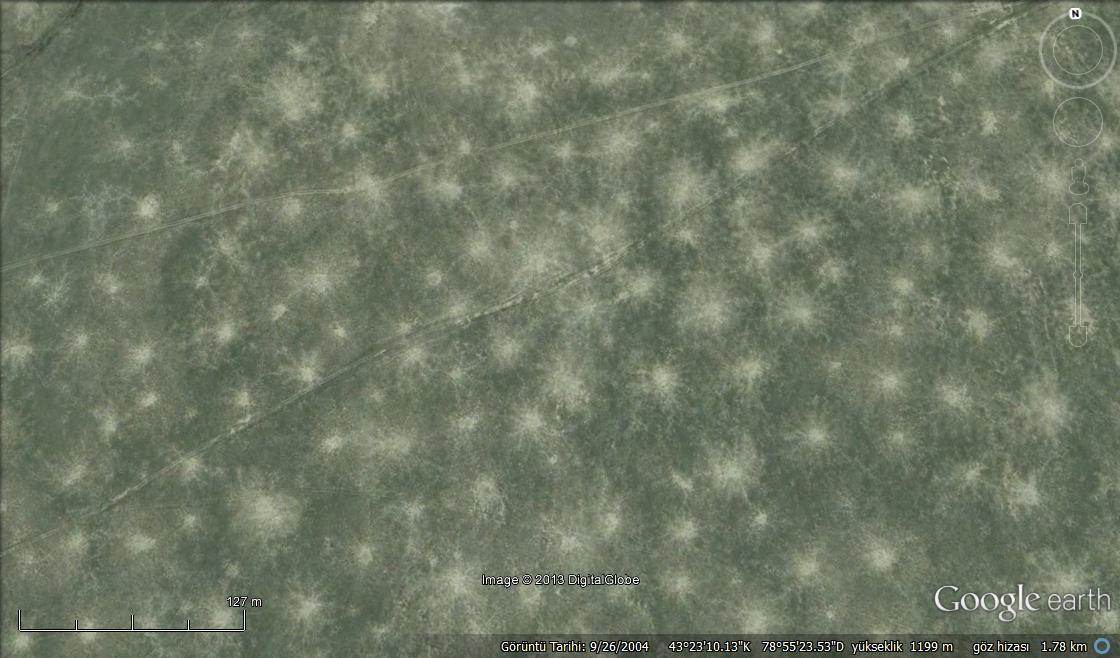
The density of the spots is truly peculiar and unlike those of the three marmot species I am familiar with. The area may host Altai/gray, Bobak, and Menzbier’s marmots, and about eight other ground squirrel species. After a quick search, I came across this website, where they describe the ‘historical’ densities of the Altai marmot as “in an area of about 25 thousand km2 lived approximately 3 million animals, 30-50 families of marmots per km-square… families graze close together, slowly moving around the site, no more than 30-40m from the hole.”
The above description kind of matched the observed pattern, but the density of the spots seemed too high and the radius too small. Maybe, it’s a smaller ground squirrel with higher population growth rates and smaller foraging habitat requirement? Infected by the curiosity of this geologist, I posted this on Facebook. Dr. Rich Grenyer, from Oxford School of Geography, responded indicating that Panoramio photo shots from Google Earth may give some clues, and to our pleasant surprise, among dozen photos of a barren steppe from that exact location, there was also this one:
 First, I thought it was a baby marmot, but the pointed nose and ears gave away the species after a bit of search: the Great Gerbil, Rhombomys opimus. Well then, can this be the culprit causing these patterns? Smaller than the marmots, burrow-dwelling, capable of reaching extreme densities, and wiki says “burrow system complexes have a distinctive region of cleared soil and can be easily seen in aerial photos“.
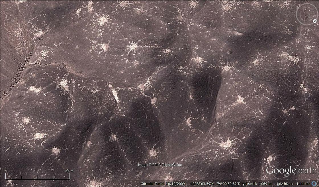
Someone even studied the plague dynamics in this species using aerial photos. Here’s a figure from their paper showing exactly the same formation:

Case closed! Curiosity won!